
Arriving in El Chalten
- willowrolfe
- Nov 17, 2025
- 5 min read
Updated: Jun 8
After visiting the glacier, we had returned to our little camp for the night, where Mark was still recovering in his tent. We made him a ‘student letter’ so he could also take advantage of the loophole in the system (it’s worth mentioning that this no longer works, unfortunately) when he visited the next day. Then we cooked another dinner for everyone as we were much better set up to do it.
In the morning, it was time for us to continue north. Mark was planning to head to the glacier and then spend some time in town fixing up his bike. It had taken an enormous beating in his accident, breaking the rear luggage boxes and front electrical gauges, as well as damaging a load of other components. We were pretty sure our paths would cross again in the future, so we lent him one of our old power banks so he could charge his phone in the meantime before we left.
The next stop on our route would be the iconic village of El Chaltén. In this rather remote region of Argentina, civilisation is few and far between. Once you leave El Calafate, you’re back into the remote pampa. The Andes Mountains dominate the skyline to the west and, to the east, nothingness stretches towards the hazy horizon.
There’s nothing between the two towns really, and hitchhikers were everywhere. Both places are very popular to visit, despite the fact that they are not the easiest to get to. Even for hitchhikers, there is surprisingly little traffic on the road. You might think that the only connection between these two places, and in fact the main road on the entire west side, would be busy. But it is surprisingly quiet.
We didn’t pick anyone up though. For some time we’d smelt a kind of exhaust smell in Ruby. At first we thought maybe it had been the broken flexible section that went all the way back in Puerto Madryn. But after re-welding that, it hadn’t gone away. It seemed like the other side also had a hole. Ideally we were trying to hold out until Chile to repair that though, and Patagonia isn’t really the place you want to be doing vehicle repairs, especially on the Argentinian side.
To combat the problem, we drove with the windows fully open. It may have only been a few degrees above zero, but the alternative was a nasty headache. Aimee too sat in the back regardless, and it can’t have been good for her breathing in all the fumes. So we blasted freezing cold air through the van and wore as many layers as possible to try and stay warm.
It’s several hours to reach the village. Firstly, you have to drive back out of El Calafate to the main road and cross the river we had previously camped beside. You then continue on the main road for a while before taking the next turning off to the left again. As the interesting things are located in the mountains, you have to keep diverting back into them.
It’s about another hour of driving once you leave the main road here. This was made even slower by the wind. As we turned and headed directly towards the mountains, we turned into the wind. It was so strong that, despite the flat road, we couldn’t get into fourth gear. Our fuel consumption went through the roof as our engine worked hard to push us forward against the wind. We knew that the view should be incredible, but unfortunately clouds hugged the mountains and the whole day was dreary and grey.


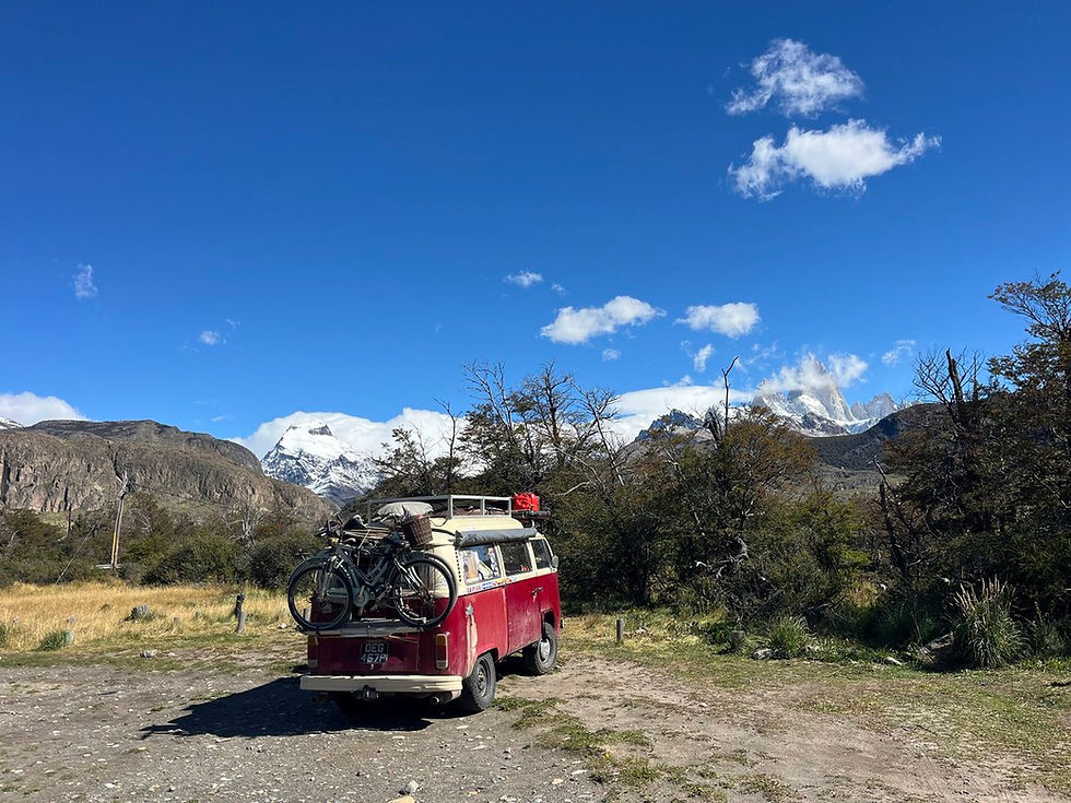
Once we had arrived, we looked at the camping options. There is a free car park on the nearer side of town, but it was mainly full of fairly permanent-looking rigs. We headed in there to use the free water tap, but then opted for a different car park on the outskirts.
The problem with camping here is that technically all the options are inside the national park (the whole town is inside) and therefore no pets are allowed anywhere. We opted for the car park with no facilities, hoping we could let the cats out into the surrounding bushes in the early morning or evening when no guards were around. There were also a few scraggly trees here that we hoped would offer some protection from the fierce wind. This car park was nearly full of vans too; this is an iconic destination after all. But we found a decent space at the end to ourselves.
The next day we awoke to clear skies and the magnitude of the view was revealed in all its glory. Mount Fitz Roy gleamed in the background, covered in fresh snow. It’s a famous mountain; if you’ve seen the branding for the company Patagonia, the mountain range on their logo is this one.
There are many walks you can do here. The most famous is to another glacier lake that sits at the bottom of this peak, much like in Torres del Paine. It’s a gruelling 22km trail with around 1,000m of elevation gain thrown in. We wanted to do it, but decided we’d start off with something more manageable.
Being that it’s a national park, the majority of the trails incur the entrance fee. That’s $90 for us to enter just to hike; the second and third day are half price. So for just three days here with access to the trails, it would cost us $360. There are no facilities, no guide. Just an entrance fee. That is insanity.
There is only really one hike that isn’t within the park. The river in the town marks its edge and so if you walk through the town, cross the river (noting the confluence of the two distinctly colour rivers) and hike on the opposite bank, you’re not inside and this is free. This is what we went for.

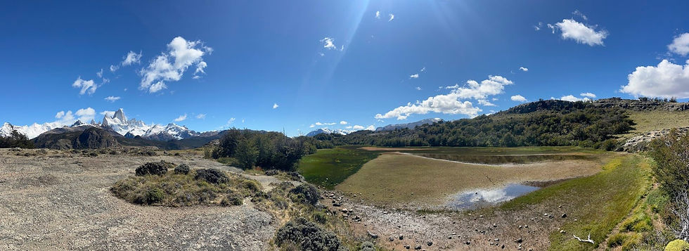
It was a glorious day. The trail starts a little way after the bridge. It’s a circular walk, and we opted to go left. We walked down a dirt track a short way before the trail forked off and began to steeply climb the hill.


As we reached the highest elevation, somewhat puffed, the town of El Chaltén was visible laid out below the mountains.


At the top, the path levels as you walk along the ridge, all the while with the mountains on your right and some small lakes to the left.
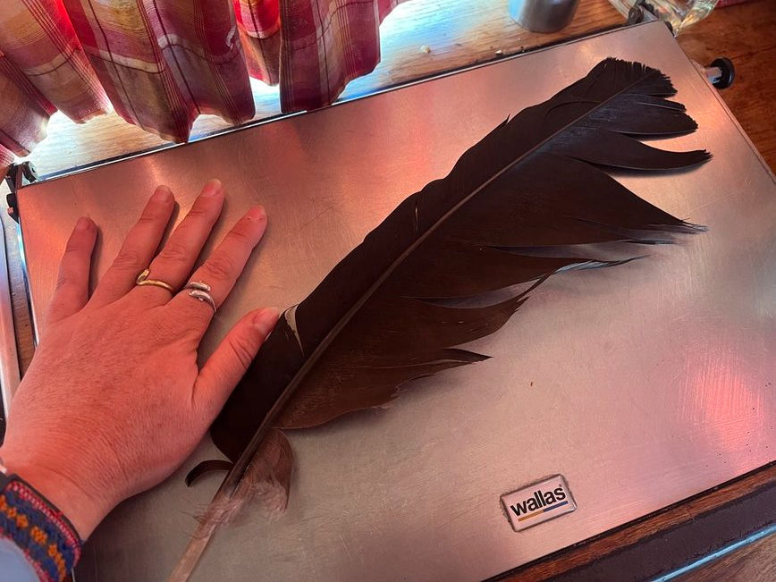
Once you get to the end, you begin the descent again. It’s a scramble down a loose dirt path on the other side. We met a few other people up here, possibly treating this like we were — a warm-up walk. Lee also spotted a condor feather on the ground. It’s amazing seeing the scale of the thing up so close. You know they’re big birds, but when you compare their feathers to a typical hawk (or just your hand), you really see it.
It was a good little walk to get ourselves ready for the big guns. We didn’t want to hike too far; hiking 20km before doing another 20km the following day had wiped us out a bit before. So this little 7km walk was a good one.
The weather was supposed to be good again tomorrow, so we decided we’d go for it. We made ourselves a packed lunch, got our clothes for the morning ready, packed water bottles and layers, and then, with everything prepared for an early start, we went out and bought ourselves a very good pizza in town.


Comments